
Hiking Pendle Hill from Clitheroe: A Scenic 12-Mile Adventure in Lancashire.
Tackling the Legendary Pendle Hill via Clitheroe.
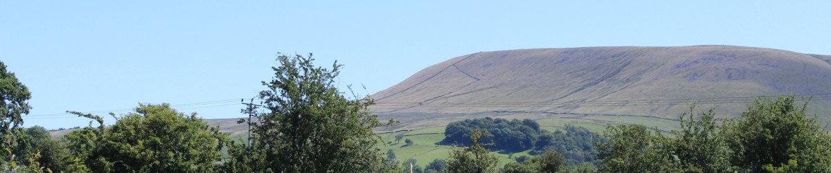
After more than a decade of longing glances and excuses, the day finally arrived: I set off to hike Pendle Hill, the iconic Lancashire landmark known for its rich history and witch trial associations. Rising from the edge of the Ribble Valley, Pendle Hill has captivated walkers, nature lovers, and history buffs alike.
My chosen starting point? The charming market town of Clitheroe, a perfect launch pad for this 12-mile circular route to the summit and back.
Starting in Clitheroe: A Historic Town Steeped in Charm.
Clitheroe is no stranger to me—I’ve visited the town many times, and on this particular day, its cobbled streets were bathed in glorious sunshine, with temperatures soaring past 30°C. The town centre buzzed with community spirit, bunting fluttered, and even the local vicar cycled by as residents waved to the local bobbies outside the old-fashioned police station, complete with its working triangular lamp.
We—myself and Austin, my energetic Jack Russell—felt instantly at home. The walk began on a high note, weaving through history, past Clitheroe Castle, and along picturesque backstreets.
Route Details: Pendle Hill Hike from Clitheroe
- Distance: 12 miles (approx).
- Duration: 5–6 hours.
- Difficulty: Moderate to hard.
- Dog-Friendly: Yes (but keep dogs on leads near livestock).
- Best Time to Visit: Spring to early autumn.
- Alternative Route Tip: For families or those seeking a shorter walk, start from Barley village. It’s just a 2.5-mile climb to the summit and more suitable for children, buggies, or casual hikers.
Using Outdooractive for Navigation – A Mixed Bag
To navigate the route, I used Outdooractive, a hiking app I downloaded in advance. It’s 2025 after all—paper maps are nostalgic, but sat-navs are the new compass. Though I submitted my route earlier in the day, the app’s guidance through Clitheroe’s winding streets was… let’s say, erratic.
We experienced multiple false starts: forwards, backwards, forwards again, only to be told to cross the same street once more. Eventually, we escaped the labyrinthine town centre and joined a peaceful, traffic-free path—shady and green, but not safe enough to let Austin off his lead.
Into the Countryside: Gates, Stiles, and Cows
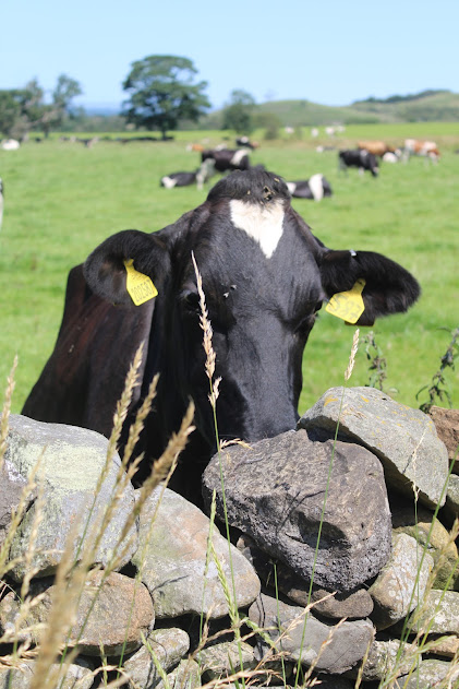
As we entered open farmland, navigation improved, albeit with a few questionable diversions. At one point, the app led us diagonally through a field of grazing cattle, while other walkers wisely took the adjacent path. Fortunately, the farmer wasn’t nearby, and Austin behaved himself with the help of a few calming treats.
However, some of Outdooractive’s instructions bordered on comical—redirecting me by mere meters left and right, like a mini orienteering course. The estimated distances were also wildly inaccurate, stating “¾ of a mile” when the path ahead was clearly no more than 20 yards.
The Ascent: Into the Forest of Bowland and Upwards
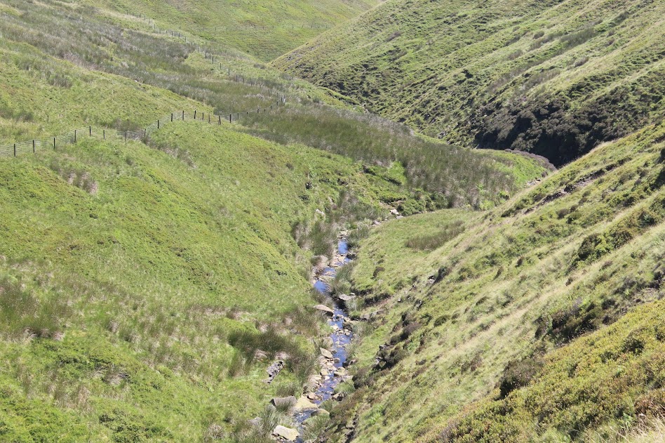
We finally began the climb through Bowland’s deep woodland, following a clear stream where I topped up my bottle with crystal-clear water and Austin cooled off. The scenery was spectacular—wild, remote, and peaceful.
Yet the app once again showed signs of confusion. We veered off course by nearly 500 yards without any visible trail ahead. Austin darted ahead with ease while I scrambled awkwardly over rocky terrain. Eventually, we rejoined the main track, and from here, the walk became more pleasant and well-marked.
The Summit: Witch Legends and 360° Views
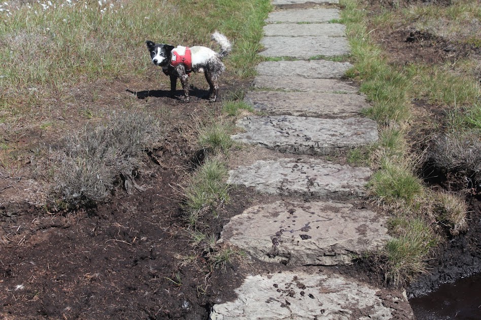
As we approached the summit, the trail mellowed. The final mile offered a gentler gradient, and with fewer sheep around, I let Austin off the lead in short bursts.
Reaching the summit plateau of Pendle Hill, I finally understood its pull. Panoramic views stretched across the Ribble Valley, and I felt an inexplicable sense of spiritual calm—a connection to the earth, history, and nature. A fleeting moment of peace… interrupted by the urge to update Facebook, post to Instagram, and record a TikTok. 2025, after all. Austin, immune to digital demands, found a bog and leapt in without hesitation. Some things never change.
The Descent: Power Loss and Going Old School
With my phone battery dangerously low—thanks to Outdooractive requiring power-saving to be off—I began my descent via the same route. I was more confident this time, sticking closely to the app’s directions, crossing dried-up marshes and open fields.
Eventually, I returned to the familiar freshwater stream, and just before the phone gave up entirely, I made it through the last stretch of farmland—this time choosing the safer, cattle-free footpath.
Back in Clitheroe, navigating without the app was refreshingly simple.
Final Thoughts: Pendle Hill Hike Review
Would I do it again?
Absolutely. Pendle Hill is a Lancashire gem—a walk through history, legend, and nature. The route from Clitheroe is longer and more demanding but incredibly rewarding. For a shorter hike or a family day out, the Barley route is ideal. If it looks to be a potentially wet day you can get great children’s waterproofs from Mucky Puddles.
Would I use Outdooractive again?
Maybe. It’s a great tool, but not without flaws. Next time, I’ll bring a traditional Ordnance Survey map as backup.
Dog Calm Treats Review: Not a miracle solution, but they helped. Austin was noticeably more manageable, especially around livestock and busy sections.
Pendle Hill Hiking Tips
- Download offline maps or bring a paper map
- Charge your phone fully and bring a power bank
- Keep dogs on leads near livestock, try dog calming treats.
- Bring water, especially in summer
- Start early to avoid hiking in the dark
Pendle Hill is more than a walk—it’s a connection to folklore, landscape, and a moment of stillness in a noisy world. I’ll be back next year, maybe to try the Barley route, or even to run it.
Until then, Pendle… stay witchy.

Leave a comment